
 Local Business, Food, Accommodation
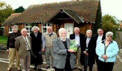
History Group
Local Events
Local Business, Food, Accommodation
History Group
Local Events


 Summary of Castle Rising


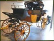
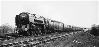
Transportation in Castle Rising Cameo
Most of the roads and tracks in the parish of Castle Rising are of ancient origin. The village lies a few miles to the west of the pre-
The system of roads that we know today was probably already in place at the time of Domesday. As King’s Lynn developed as a port and overtook Castle Rising in importance, we have evidence of another road between Castle Rising and King’s Lynn via Gaywood. This was probably used by Queen Isabella, our most famous medieval resident. Her son, King Edward III, also used to visit Rising Chase and the Castle and probably used this road, which at that time skirted the ancient deer park.
As water access to the village became increasing difficult because of the silting up of the Babingley River, land routes became more important. These were maintained by the county authorities but local residents were then charged with the costs. This often led to conflict between road users and local residents. In the late 18th century, however, a Turnpike Act led to the construction of a toll road between King’s Lynn’s East Gate and the village of Dersingham to the north of Castle Rising. Tolls were collected at the south side of the bridge over the Gaywood River. The road passed through Castle Rising, but the Act stated specifically that stone from the castle could not be used for road construction. Maintenance of the turnpike road continued to be a contentious issue, but transport links were nevertheless much improved. By the mid 19th century public transport, in the form of a horse-
 transportation
further reading on transport thought the ages click on button